Klamath Falls Today & Home Tomorrow
October 3rd (169 Miles Today):
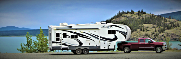
We left Redmond at 11am and traveled south on Highway 97, through Bend, La Pine and Klamath Falls.
Arrived at the Midland Rest Area just south of Klamath Falls at 2pm. The rest area is off the highway and quiet this time of year.
Tomorrow we’ll get an early start and connect with I-5 and be home about noon.
Had a great time on this adventure. We really enjoyed exploring the state of Montana and Glacier National Park.
Next excursion in the trailer will be January 2022 to the Desert South-West.
Total miles this trip: 4,312
Next excursion in the trailer will be January 2022 to the Desert South-West.


_______________________________________________________________________________
Redmond, Oregon
October 2nd (181 Miles Today):
We left the Boardman area at 10am and traveled west on I-84 to Maryhill, then south on Highway 97.
The first hour of our drive was along the Columbia River.
Could see Mount Rainier, Mount Hood and the Three Sisters Mountain Range once heading south.
Traveled through several small towns and arrived at the Fairgrounds RV Park, in Redmond at 2pm.
We’ll be spending one night in Redmond and continuing south towards Klamath Falls tomorrow.


_____________________________________________________________________________
Boardman, Oregon
October 1st (180 Miles Today):
Had a rainy and foggy night last night in Spokane.
We left the Spokane area at 10am and traveled south on Highway 395 through Ritzville, Connel and Kennewick.
We crossed over the Columbia River into Oregon, at Umatilla along I-82.
Arrived at the Boardman Rest Area a few miles later at 2pm. The rest area is small, with few spaces.
We drove west a mile and stopped at the Loves Truck Stop. We found a choice quiet spot in the far corner for the night.
Tomorrow, we’re off to Redmond, Oregon.


_______________________________________________________________________________
Spokane, Washington
September 30th (167 Miles Today):
We left Libby, Montana at 10am and traveled west on Highway 2 into Idaho.
Continued on Highway 95 through Coeur d’ Alane and west on I-90 into Washington state & Spokane.
We arrived at the Northern Quest Casino at 2pm.
This is just an overnight stop, so we’re staying in the casino parking lot overnight.
With all the interstate city traffic, we’re already missing the quiet Montana roads.
Tomorrow, we’re off to the Boardman Rest Area (Oregon) along the Columbia River.


______________________________________________________________________________
Kootenai Falls and the Swinging Bridge
September 29th:
We had sprinkles and a little rain last night, with a dusting of snow on the ridge above our campground. It was nice listening to the rain on the RV roof, while dry and warm inside.
We left camp for the Kootanai Falls trailhead after breakfast and hiked the trail to the falls.
Downstream from the start of the trail, the Kootenai River enters a canyon and flows over Kootenai Falls, one of the largest free-flowing waterfalls in the northwest.
The falls and surrounding area are considered sacred to the Kootenai Indians, whose ancestors inhabited the region.
Below the falls is the famous Kootenai Swinging Bridge.
During the Depression in the 1930’s, the CCC (Civilian Conservation Corps) crews did a lot of work in the area constructing roads and bridges, including the first swinging bridge, across the Kootenai River.
We hiked up to the bridge, once crossing the area’s busy railroad tracks and walked across the river. Swings a little, but not too bad.
After our hike, we filled up with fuel and got a few groceries.
Tomorrow we leave for the Spokane area.


_________________________________________________________________________________________
Eureka, Montana
September 28th:
Saw Deer roaming around our campground just before dark last night. Had cooler temperatures in the low 40’s and rain.
The park closes on Thursday, and we’re one of the last RV’s in the park.
After breakfast, we drove about an hour north on Highway 37, along the shore of Lake Koocanusa, past the Libby Dam and to the small town of Eureka, Montana.
Eureka is just a couple miles south of the Canadian border (still closed).
Eureka was founded in the early 1880s as settlers moved north from Missoula and south from Canada and was originally known as Deweyville.
It was one of the last areas to be developed in Montana in frontier times, and logging was a major draw and source of income for decades.
Eureka was once known as the “Christmas Tree Capital of the World”, with evergreens shipped to many urban points for holiday sales.
We visited the history Museum Village, walked the main street and had a picnic overlooking the river.
Once returning to Libby, we visited the Libby Historical Village, and learned all about the area’s logging and farming history.
Tomorrow we hike to the Kootenai Falls and nearby Swinging Bridge.


________________________________________________________________________________
Libby, Montana
September 27th (104 Miles Today):
We left Columbia Falls at 10am and traveled west on Highway 2 to Libby, Montana. We had on & off sprinkles during the drive.
We stopped along Thompson Lake for lunch.
Continental and alpine glaciers shaped the area’s valleys and lakes.
The earliest known American settler, David Thompson, arrived in the 1800s, and early American economic activity included “fur trading, railroad construction, mining, and logging.
Miners flocked to Libby Creek in 1867. It was deserted by the 1870s. “Libby Creek” was named by prospectors in the 1860s after one of their daughters, and it is believed that the town of Libby was named after this creek.
In 1892, with the arrival of the Great Northern Railway, the town moved downstream and the name was shortened from Libbysville to Libby.
We arrived in Libby at 1pm to the Woodland RV Park. Light rain started 30 minutes after we set-up camp. Rain forecast for tonight.
We’ll be staying in Libby for three nights.


_______________________________________________________________________________
Glacier National Park Boat Tour
September 26th:
Woke up to a nice sunrise at camp. Rain and cooler temperatures start tomorrow in western Montana.
We re-entered the Glacier NP and arrived at Lake McDonald, at 1pm.
We previously made tour reservations aboard the 1928 boat – SS DeSmet. Just so happens, today was the last sailing of the boat for the 2021 season.
Boat tours have been sailing on Lake McDonald since 1938.
During the boat tour, we learned about the lake, the area and the national park. It was a beautiful day to be on the water.
Tomorrow we leave for Libby, Montana.


___________________________________________________________________________________
Hungry Horse Dam
September 25th:
After two days of strenuous hiking starting at 6am, we slept in this morning and had a leisurely breakfast.
After noon, we went to the nearby U.S. Bureau of Reclamation – Hungry Horse Dam and their visitor’s center.
The 564 foot dam was constructed on the Flathead River. It was the third largest and second highest concrete dam in the world at the time of its completion in 1953.
After having a picnic lunch overlooking the dam, we took a free guided tour of the dam and the grounds.
Tomorrow is the Glacier National Park – Lake McDonald Boat Tour


_________________________________________________________________________________
Glacier National Park (Day 3)
September 24th:
Got up at 5am and out the door at 6am. We arrived at the Avalanche Trailhead at 6:30am to get a parking spot in the lot.
It was still dark and the last thing anyone wants to do, is venture into the bear infested forest without at least some daylight.
We started out today’s trek at 7:30am into the Trail of the Cedars Trailhead, and after a mile, that trail intersects with the Avalanche Lake Trail.
We hiked through forested areas and along a creek for 5+ miles until arriving at Avalanche Lake. Didn’t see any grizzly or black bears today.
The trail gained an elevation just shy of 1,000 feet and with the starting trailhead elevation, made for a good tiring hike.
We spotted some Mountain Goats on the cliffs above the lake while having a snack.
Tomorrow is the Hungry Horse Dam.


__________________________________________________________________________________
Glacier National Park (Day 2)
September 23nd:
We left or RV park at 6am to beat the fall hiking crowds at the park.
We see very few hikers. but the 1920’s era parking areas are small and go fast, especially after 8am.
We drove to the north end of Lake McDonald and continued up Logan Pass to the Visitor’s Center. We arrived just after daybreak.
The trailhead starts and climbs to Hidden Lake, to an elevation of 6,700 feet. It was well below freezing with winds during the hike, but we were prepared.
The trail is about 3 miles. The lower trail down to the lake was closed due to recent grizzly bear activity.
We could see a Mountain Goat in the distance, but didn’t see any bears.
We had lunch at Logan Pass and continued to the East Park Entrance at St. Mary and home.
Morning temperatures have been in the low 30’s and afternoons in the 60’s. No smoke whatsoever after rains a few days ago.


__________________________________________________________________________________
Glacier National Park (Day 1)
September 22nd:
We left our RV park at 8am and traveled 20 minutes to the west entrance of the Glacier National Park.
Used our ‘Lifetime Senior Park Pass’ and entered the park – Thank you President Bush!
We soon came upon the Apgar Visitor’s Center to pick up a map of the park and get some travel advice.
Drove the “Going To The Sun Road” that traverses the entire park, traveling over mountain passes and valleys.
It’s a very narrow two-lane road & not for the faint of heart – especially in a large truck.
We hiked the John’s Lake Trail for a few miles. Started in the fog, ended in the sunlight.
We also saw a grizzly bear foraging for food near Logan Pass.
Tomorrow we’ll return to the park for some early morning hiking.


_______________________________________________________________________________________
Columbia Falls, Montana
September 21st (128 Miles Today):
We left the Missoula area at 10am and traveled north on Highway 93. Yesterday’s rain & snow has been replaced by warmer weather and sunshine.
Traveled through the small towns of Arlee, Polson, Kalispell and along the Swan Mountain Range & Flathead Lake into Columbia Falls.
Columbia Falls is known as the gateway to Glacier National Park.
Arrived at the beautiful Columbia Falls RV Park at 1pm. We’ll be spending six nights here.
Tomorrow we’ll venture down the road into the nearby Glacier Park.


_________________________________________________________________________________
Garnet Ghost Town
September 20th:
We left Missoula at 11am and traveled east on Highway 200, then south on the Garnet Range Road near Greenough, to the Garnet Ghost Town.
Garnet started in the 1860’s as a small gold mining town. By the 1890s, thanks to gold, it was the residential and commercial center of the area.
In 1898, as many as 1,000 people lived in Garnet, but it was abandoned 20 years later when the gold ran out. A fire in 1912 destroyed half the town, which was never rebuilt.
We walked the streets and explored the hotel, miner’s houses, saloon and other buildings. We had a picnic lunch where miners once lived & worked.
Dropped down into the mid-30’s after lunch and while exploring the town, had light sleet & snow. We brought along lots of warm clothing just in case.
Tomorrow we’re off to Columbia Falls, Montana.


________________________________________________________________________________________________
Missoula, Montana
September 19th (123 Miles Today):
We left Butte at 8:30am and traveled north on Highway 90. Had some off & on rain showers, with temperatures in the high 40’s.
Arrived in the little town of Deer Lodge and stopped for a few hours to tour the Old Montana Territorial Prison & Museum.
In response to rampant lawlessness and the vigilante-style form of justice present in the newly formed Montana Territory, in 1867 the US Congress allotted $40,000 to Montana for the express purpose of constructing a territorial prison.
The “Old Prison” served as the Montana Territorial Prison from its creation in 1871 until Montana achieved statehood in 1889, then continued as the primary penal institution for the State of Montana until 1979.
In 1959, a riot broke out and the assistant warden was killed. The National Guard stopped the riot by firing a bazooka into the cell-house (see yellow arrow of damage).
After touring the prison, nearby connected car museum, frontier museum and lunch, we continued on Highway 90 to Missoula, Montana.
We arrived at Jim & Mary’s RV Park at 3pm. This is a family-owned park with full services. We’ll be in Missoula for two nights.
Tomorrow, we’re off to explore the Garnet Ghost Town.


___________________________________________________________________________________
Bannack, Montana
September 18th:
Last night we went to a very nice steakhouse in Butte. Was housed in an old 1800’s beer warehouse. Delicious food.
After breakfast, we drove south on I-15 just over an hour to the old gold rush town of Bannack, Montana.
Founded in 1862 and named after the local Bannock Indians, Bannack was the site of a major gold discovery in 1862, and served as the capital of Montana Territory briefly in 1864, until the capital was moved to Virginia City.
Bannack continued as a mining town, though with a dwindling population. The last residents left in the 1970s.
At its peak, Bannack had a population of about ten thousand. Extremely remote, it was connected to the rest of the world only by the Montana Trail. There were three hotels, three bakeries, three blacksmith shops, two stables, two meat markets, a grocery store, a restaurant, a brewery, a billiard hall, and four saloons.
Though all of the businesses were built of logs, some had decorative false fronts and a few made out of stone or brick.
We walked the streets, explored the buildings and had a picnic lunch in the town.
Winds picked up in the afternoon to 45mph gusts. Rain and cooler temperatures in the forecast.
Tomorrow we leave Butte for Missoula, Montana.


__________________________________________________________________________________________________
Orphan Girl Mine
September 17th:
The ‘Orphan Girl’ mine (located near downtown Butte) was started in 1875 and eventually operated to a depth of over 3,000 feet.
While not a huge producer according to Butte standards, by 1944 hard-rock miners had removed a respectable 7,626,540 ounces of silver as well as lead and zinc from her depths.
The 65 degree mine was a desirable place to work, unlike some “hot boxes” where temperatures could top 100 degrees.
By the end of the 1920s, the Anaconda Company owned the ‘Orphan Girl’ which operated until the 1950s.
We explored the massive 22 acre outdoor town & yards, the indoor museum and took a 1.5 hour tour of the underground mine shafts.
Tomorrow we’ll explore the Bannack, Montana Ghost Town. Weather forecast is for 50mph winds in the Butte area over the next two days.


____________________________________________________________________________________________
Butte, Montana
September 16th (66 Miles Today):
Due to the short drive today, we left the Helena area at noon.
Traveled south on I-15 to the town of Butte, Montana.
Established in 1864 as a mining camp in the northern Rocky Mountains on the Continental Divide, Butte experienced rapid development in the late-nineteenth century, and was Montana’s first major industrial city.
In its heyday between the late-nineteenth and early-twentieth centuries, Butte was one of the largest copper boom towns in the American West. Butte’s mining and smelting operations generated in excess of $48 billion worth of ore.
We’re staying three nights at the Butte KOA.
Forecast is in the high 20’s tonight for the Butte area…. Fall is here….. Brrrrrrrr.
Tomorrow we take an underground tour of the ‘Orphan Girl Mine’.


_______________________________________________________________________________________________________
Gates Of The Wilderness Boat Tour
September 15th:
We drove north of Helena to the Helena National Forest and the Missouri River at the Gates of The Mountains Wilderness.
In July of 1805, the Lewis and Clark expedition passed through the area naming the canyon the “Gates of the Rocky Mountains”.
We boarded a large passenger boat for a two hour history / nature tour of the Missouri River and the Montana wilderness area.
A little cooler today and windy. Will be getting colder at night from here forward.
Tomorrow we leave the Helena area for Butte, Montana.


____________________________________________________________________________________
Lewis & Clark Caverns State Park
September 14th:
We left the Helena area bright & early and drove south on I-15 for an hour to the Lewis & Clark Caverns State Park.
The Lewis and Clark Expedition camped within sight of the caverns in 1805, when they camped along Antelope Creek.
In 1892, local ranchers saw steam coming from the caverns while hunting and discovered the cavern opening.
The cave was first developed for tours around 1900. A mineral claim was filed on the land in 1905, but the Northern Pacific Railroad disputed that private claim and filed a court case against the claim.
The railroad won the court battle and then handed the land over to the federal government.
The site was first officially established as “Lewis and Clark Cavern National Monument” in 1908, but was not fully surveyed and declared until 1911. It is now a Montana state park.
We walked the half mile trail to the cavern entrance, then took a 1.5 hour tour of the underground cavern complex.
After lunch, we drove back into Helena and walked around the Montana State Capitol. We also drove the nearby streets where the rich mine owners once lived in their 1800’s era mansions.
Tomorrow we’re off to do a boat tour of the Missouri River.


________________________________________________________________________________________
Helena, Montana
September 13th (103 Miles Today):
We left Bozeman at 11am and traveled north-west on I-90, then north on Highway 287 at Three Forks.
Drove through the towns of Toston, Townsend and Winston and over the Missouri River. Arrived in Helena at 1pm.
Helena (Montana state capitol) was founded as a gold camp during the Montana gold rush, and established in October, 1864.
Due to the gold rush, Helena would become a wealthy city, with approximately 50 millionaires inhabiting the area by 1888, more per capita than in any city in the world.
The concentration of wealth contributed to the city’s prominent and elaborate Victorian architectures downtown.
We will be staying three nights at the Helena KOA Park.


______________________________________________________________________________________________
Grotto Falls Hike
September 12th:
We drove south-east of Bozeman 30 miles into the Gallatin National Forest, to the Grotto Falls Trailhead – Elevation 7,200′ / Temperature 49 degrees.
Since we’re in “bear country”, we carried bear spray with us during the hike.
The trail was relatively easy and is only three 2.4 miles, along mature pine trees and looming nearby mountains.
The Grotto Falls were beautiful and had areas below the falls for swimming. It wasn’t warm enough for a cold dip in the ice-cold water.
We had a picnic lunch overlooking Hyalite Lake, after our hike.
Tomorrow, we’re leaving the Bozeman area and traveling to Helena, Montana.


_________________________________________________________________________________________________
Old Virginia City
September 11th:
Last night at 6pm, we had a Severe Thunderstorm Warning for the south-west Montana area – but only had some minor winds and sprinkles during the night.
Today was 15+ degrees cooler than yesterday. Fall is in the air in Montana!
After breakfast, drove about 90 minutes north-east to the old mining towns of Virginia & Nevada Cities (just down the road from each other.
In the 1880s, Virginia City was one of the two major centers of Commerce in what was known as one of the “Richest Gold Strikes in the Rocky Mountain West”, sharing this role with its sister city, Nevada City.
Virginia City, settled June 6, 1863, contemporary in settlement with nearby Nevada City, as miners following the Fairweather party settled the length of Alder Gulch, and established homes, and businesses in convenient locations.
The length of the gulch was known as the “14 Mile City”, until the gold dried up in 1922. Over $100,000,000 in gold was taken from the area.
The town now consists of a free open-air walking museum that includes 108 buildings and restaurants, shops & stores. Many have original furnishings still inside.
We walked the streets, took a trolley tour on an old fire truck, visited the free city museums & Boot Hill and had a picnic in town.
Tomorrow, we’re off to the forest for a hike to Grotto Falls.


____________________________________________________________________________________________________
Bozeman, Montana
September 10th (90 Miles Today):
We left West Yellowstone at 11:00am and traveled north on Highway-191.
This area of Montana is mostly mountainous forest lands and small ranches.
We arrived in Bozeman at 1:00pm.
Today was in the high 80’s, but the weather pattern will be changing tonight, with thunderstorms / sprinkles and highs in the 70’s for tomorrow. Bozeman area RV parks all shutdown for the winter in three weeks (October 1st) due to freezing temperatures.
We’ll be staying three nights at the Bear Canyon Campground, about 5 miles outside downtown Bozeman.
Tomorrow we’re off to the Old Virginia City.


____________________________________________________________________________________________
Yellowstone National Park
September 9th:
We hit the west gate of Yellowstone at 7:00am. The crisp fall morning was 32 degrees with frost on the ground, but clear.
We first wandered in the Norris Geyser Basin before the crowds came into the park.
Next was a short drive to the Yellowstone Falls and the Canyon Village Area.
We then drove north to Mammoth Hot Springs, the Roosevelt Arch at the north gate to the park and the small town of Gardiner outside the Gate.
In 1903, the US Army (which guarded the new Yellowstone NP) constructed an arch that was dedicated by President Theodore Roosevelt, who laid the cornerstone at a ceremony that drew thousands of guests, and much fanfare.
Original plans called for the curved walls on either side of the Arch to surround a landscaped garden, two ponds, and a waterfall. However, this plan proved impossible due to the area’s arid climate.
Tomorrow, we head north to Bozeman, Montana for a three night stay.


________________________________________________________________________________________________
Yellowstone & Grand Teton National Parks
September 8th:
We entered Yellowstone at 8:00am and almost immediately entered from Montana into Wyoming inside the park.
Traveled south-east towards the main visitors center complex and the Old Faithful Geyser.
Walked the shops, toured the Old Faithful Inn hotel, the education center and of course, watched Old Faithful erupt.
We then explored several other geyser locations, mud pots, waterfalls and drove into the Grand Teton National Park, which is just south of Yellowstone.
Tomorrow, we’re off to explore the north side of Yellowstone.


____________________________________________________________________________________________
West Yellowstone, Montana
September 7th (148 Miles Today):
We left Fort Hall at 10:00am and traveled north on I-15 to Idaho Falls, which then turned into Highway-20.
We left the farm lands and soon entered into forest lands and pine trees. Today’s drive was a little cooler.
Arrived in West Yellowstone at 2:00pm — Elevation 6,700′.
West Yellowstone (‘Gateway to Western Yellowstone’) was founded in 1908, when a short line railroad terminated at the town’s train depot. Travelers then entered Yellowstone National Park via stage coach, and later open-air tour wagons.
The train service ended in 1960, when private automobiles became popular, but the old train depot and railroad dining hall is still standing, now as the town museum.
We’ll be spending three nights at the Grizzly RV Park right in town, and only a two minute drive to the west entrance to Yellowstone National Park.


__________________________________________________________________________________________________
Fort Hall, Idaho
September 6th (170 Miles Today):
After yesterday in the high 80’s, this morning was in the high 40’s – nice sleeping weather.
We left Jackpot, Nevada at 11:00am and drove north on Highway-93 into Idaho. Continued light smoke in the sky, from the Northern California / Southern Oregon forest fires.
This area of Idaho is mostly corn and potato farms, and followed the Snake River the last half of today’s journey.
Traveled through Twin Falls and then onto I-86 to Pocatello and a few miles north to Fort Hall, Idaho.
Trappers frequented this area, along with native Shoshone Indians in the early 1800’s. Fort Hall was built in 1834 to service the fur trade, but US Army abandoned the fort during the Civil War.
In 1867, the US Government established the Fort Hall Indian Reservation. Shoshone tribes were displaced from their native lands and placed at Fort Hall. The Army built a new fort in 1870 to supply & protect wagon trains traveling to the west.
We’ll be spending one night at the Shoshone Casino RV Park. This is our second casino stop this trip so far, but haven’t so much as dropped a penny in a slot.
Tomorrow we’re off to Montana and West Yellowstone.


_________________________________________________________________________________________________
Jackpot, Nevada
September 5th (239 Miles Today):
Had a nice cool night in the upper 40’s last night, and left Winnemuca at 9:00am and continued east on I-80.
Traveled through the areas and towns of Battle Mountain, Elko and Wells. At Wells, we had lunch along the roadway, then turned north on Highway-93 towards Idaho.
About 65 miles north of I-80, is the small remote town of Jackpot, Nevada. Jackpot sits right on the Nevada / Idaho border.
After Idaho outlawed gambling in 1954, “Cactus Pete” Piersanti moved his slot machine operations from Idaho to Jackpot, and opened a casino.
Cactus Pete’s Casino is still open to this day and is really the only reason Jackpot is still a town, along with a gas station and another small casino.
We’ll be staying one night in the shaded 93-space RV park at the casino.
Tomorrow we’re off to the Pocatello, Idaho area.


____________________________________________________________________________________________________
Winnemuca, Nevada
September 4th (284 Miles Today):
We left Rocklin (Home) at 9:00am and soon got onto east-bound Interstate 80.
Had a easy ride over the Sierra Mountains and stopped for lunch at the Donner Pass Rest Area. We had smoke in the air from the Tahoe area forest fires.
After lunch, we continued east past Reno and out into the high desert of Great Basin.
Normally we stop at the Cosgrave, Nevada Rest Area for the night when traveling east, but since it’s still summer (HOT) in the desert, we continued to Winnemuca.
Since Winnemuca is the half-way point between Salt Lake City and San Francisco, it was a 1800’s train stop for the trans-continental railroad.
We arrived at the New Frontier RV Park at 3pm. Sunny and 90 degrees. We’ll be staying at this new full-service RV park for one night.
Tomorrow we’re off to the Idaho border.


______________________________________________________________________________________________________________
We’ll be leaving in the first week of September for a four and a half week excursion to Yellowstone and Glacier National Parks, along with many other stops.
Check back in September.

_______________________________________________________________________________________________________________
